Tsqúqw7e
A Small BayVoiced by: Lucy William
Secwépemc place names visible from Landmark site
K̓ucmép
Hollow part of the mountain
Stelteglxús
Steep drop and the water foams up (Chase Creek Falls)
Tsqúqw7e
A small bay
Quaaout (Skwláx spelling) or Qw7ewt (Cstélnec spelling)
First place where the suns rays hit in the morning
Necelclánk
Steep hillside
View All Landmarks on Map
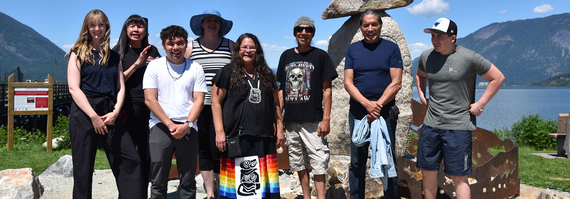
About the Tsqúqw7e Landmark Sculpture
Tsqúqw7e Landmark Artists
Mike "Savage" Peters, Lone White Wolf Peters, Shayne Hunt, David Jacob Harder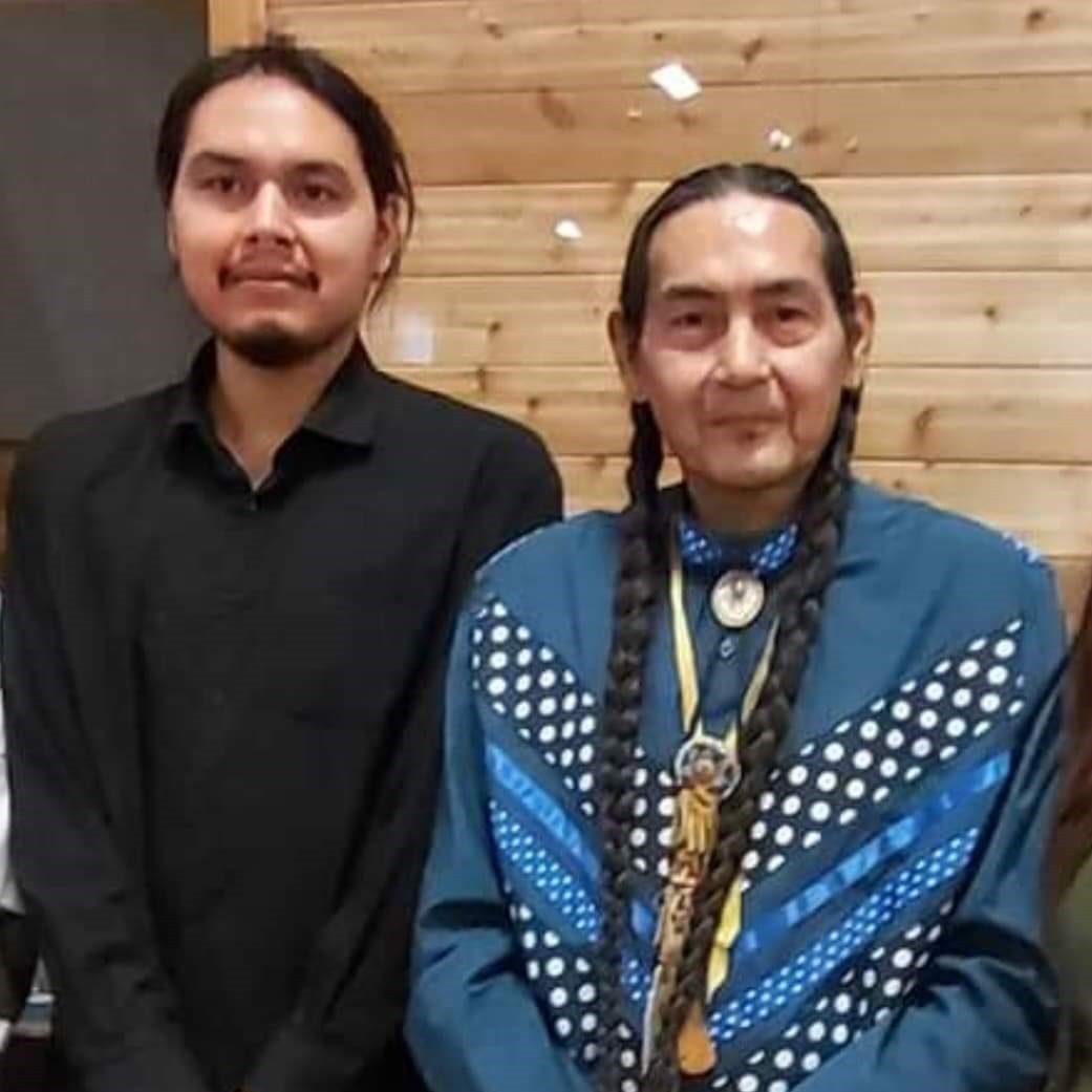
Coyote Rock Landmark Artists:
Mike Peters and Lone White Wolf
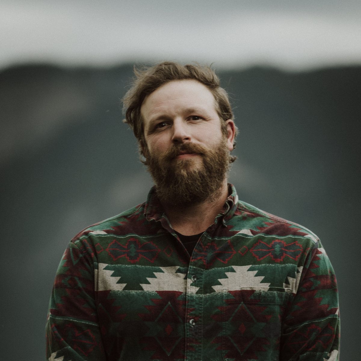
Coyote Rock Landmark Artist:
Shayne D. Hunt (Secwépemc, Skwlāx te Secwepemcúl̓ecw)
Photo by Billie Jean Gabriel
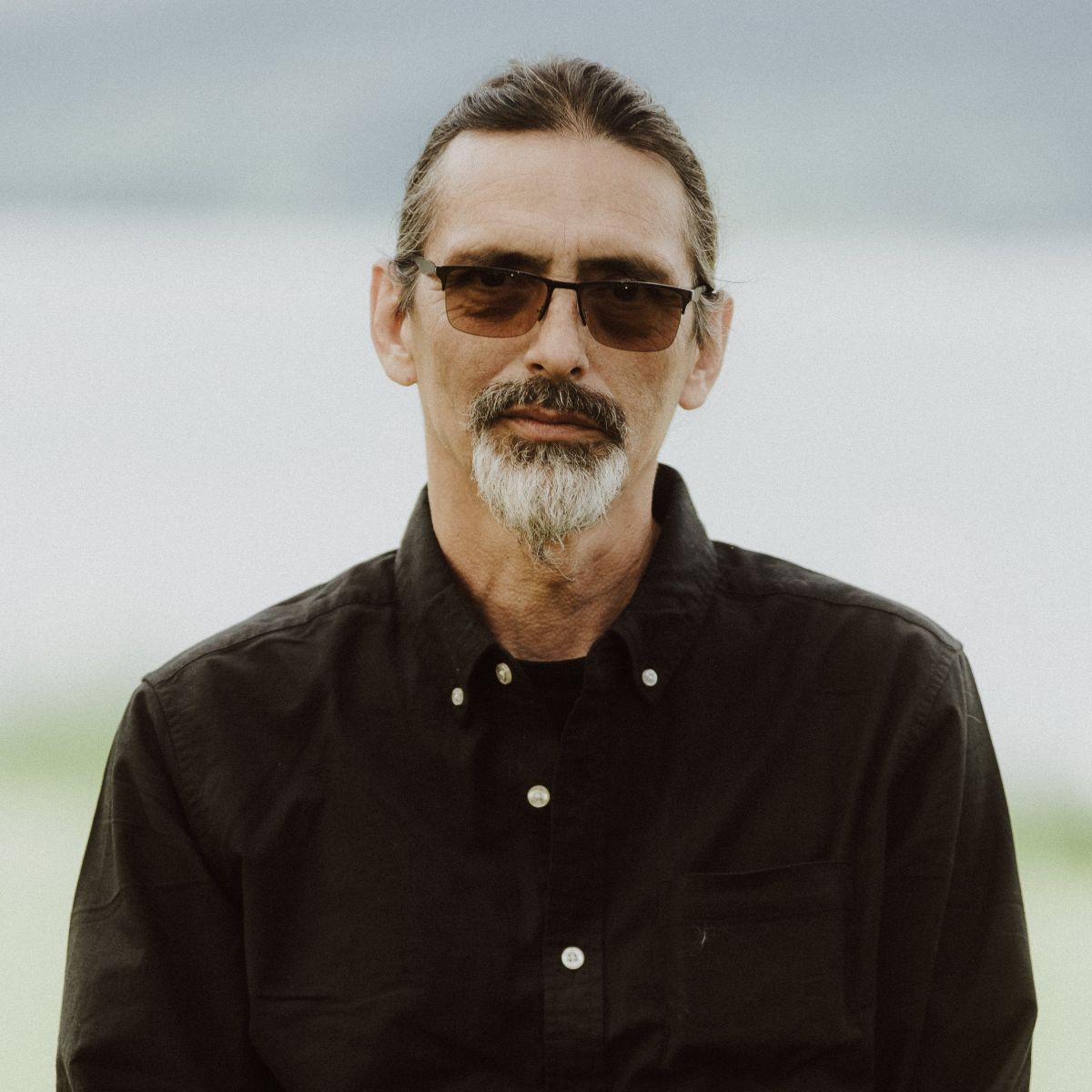
Metalwork Landmark Artist:
David Jacob Harder
Photo by Billie Jean Gabriel
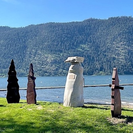
Tsqúqw7e, pronounced ch-kokw-a, is the place name for this area, meaning “a small bay” in Secwepemctsín (Secwépemc language). Tset'sxúl'ecwmec means to look at the land and stselxmúl'ecwmec means to know the land. Learning our place names is honouring our knowledge about the landscape and what happened here long ago. Our history on the land is anchored through our place names, our actions, and our continued responsibilities to our lands and waters.
Water is the source and provider of all life. There are three large rivers that pass through Secwepemcúl'ecw: Secwepemcétkwe (South Thompson River), Simpcwétkwa (North Thompson River), and the Columbia River. Looking through the viewing portals in the Tsqúqw7e Landmark, you can also see Stelteglxús (Chase Creek Falls), meaning “steep drop and the water foams up.”
Our ancestors had a village site in Tsqúqw7e where generations of our people cultivated metsúkw (black caps), tkwlóse (chokecherries), roots, and meláme (medicines); speared salmon; harvested pine and fir cones; and hunted. Our oral histories continue to anchor past, present, and future generations of Secwépemc to this place.
Note: The Cstélnec, Skwláxec and Sk'etsinec te Secwépemc people are part of the larger Secwépemc Nation and therefore have rights and responsibilities to the cultural knowledges and symbols included in this project. Any Intellectual Property Rights associated with these Secwépemc cultural knowledges and symbols inherently belong to the Secwépemc people and cannot be copied or adapted without permission.
Secwépemc Landmarks Project Background
The Secwépemc Landmarks Project is a Secwépemc-led arts project in the Shuswap Lakes region of Secwepemcúl'ecw, featuring a series of 15 Landmark sculptures carved by Secwépemc and non-Secwépemc contemporary artists. Each sculpture features Secwépemc oral histories and place names from the Secwépemc Lakes Elders Advisory Committee.
Secwépemc (“the spread-out people”), a Nation of 32 Interior Salishan communities that have been divided into 17 bands by the Indian Act, are 12,000 people strong and growing. Before contact with Europeans, the original population is estimated at 25,000 people, drastically reduced to 7,000 due to the 1862 smallpox epidemic. Secwépemc territory spans approximately 180,000 squared kilometres (112,000 squared miles) which includes the headwaters of the two largest river systems in British Columbia; the Columbia and Fraser River valleys, and extends south to the Arrow Lakes. Secwépemc have occupied their territory, Secwepemcúl̓ecw, for over 10,000 years and have never signed away, ceded or sold their land or territory.
.JPG)
Initial Project Concept, Tk'wemi'ple7 Shelley Witzky and Jacob Sutra Brett. Photo by Martha Wickett, Salmon Arm Observer.

Secwépemc Landmarks Elders Advisory Committee
Acknowledgements
The Secwépemc Landmarks project is led by Adams Lake Band, Neskonlith Band, Skwlāx te Secwepemcúl̓ecw, and Splatsín, with administrative support from the Shuswap Trail Alliance. The Secwépemc Landmarks Project Team would like to acknowledge with heartfelt gratitude the many community members and sponsors who have made this project possible.
The Secwepemctsín place name audio recordings are by Lucy William, Donna Antoine, and the late Neskonlith Elder Dr. Mary Thomas, whose work as a knowledge keeper and environmentalist inspired many about Secwépemc values of knucwentwécw (helping one another) to learn about and protect Secwépemc traditional plants for future generations. Secwepemctsín language revisions for the place names transcriptions and signage were completed by the Cstélnec Elders at Chief Atahm School and Donna Antoine (Splatsín dialect).
The Secwépemc Lakes Elders Advisory Committee, made up of Elders from Adams Lake Band, Neskonlith Band, Splatsín, and Little Shuswap Lake Band, guided this project. Each Landmark sculpture represents oral histories connected to each place. The Project Team would like to acknowledge the contributions and guidance of all Elders attending the Secwépemc Lakes Advisory Committee meetings.
The Project Team is made up of Shelley Witzky-Spemulecw (Project Manager), Libby Chisholm (Project Coordinator), Dorry William (Elders Coordinator), Ash Simpson (Splatsin Title and Rights), and previous contributors include Micky Tomma (Research Assistant), and Qwelmínte Secwépemc interns Devin Doss and Mackenzie Creasser. Landmark Artists include Tania Willard, Kel-c Jules, Rod Tomma, Tilkotmes Tomma, the late Mike Peters, Eric Kutschker, David Jacob Harder, Shayne Hunt, Hop You, Tony Antoine, Vern Clemah, Jules Arnouse, Rick, and Kenthen Thomas (storyteller).
The Secwépemc Landmarks project is funded in part by Adams Lake Band, Neskonlith Band, Little Shuswap Lake Band, Splatsín, the Shuswap Trail Alliance, the Province of British Columbia, Shuswap Tourism, the City of Salmon Arm, SASCU, Hard Rock Granite, Heritage BC through the Heritage Legacy Fund, as well as through in-kind donors such as AIM Roads, the Salmon Arm Arts Centre, School District No. 83, Switzmalph Cultural Society, Len Lega, and Browne Johnson Land Surveyors. Kukstsémc also to staff and students from Shihiya, Chief Atahm, Jackson, Sullivan, SMS, and South Canoe schools for their work on the Secwépemc Landmarks trailhead posts.
Exploring Respectfully
Shuswap Trails
Fostering a healthy, engaged community in the Shuswap Region – economic/environmental/social – through well designed, maintained, and promoted trails connecting people, culture, and landscape