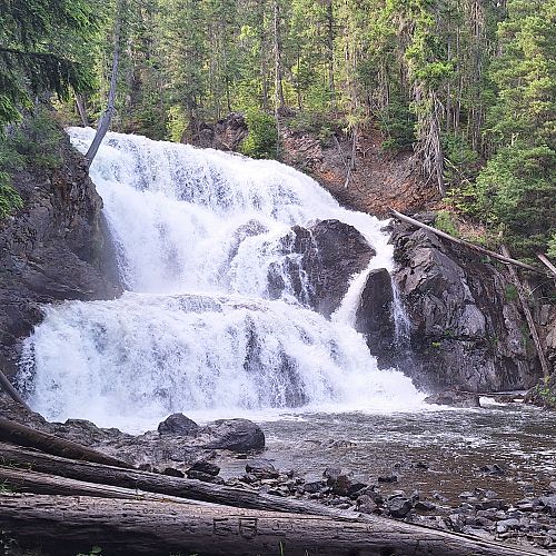
Albas Falls
North Shuswap
Trail Information
| Distance | 350 m (one-way to beach); 3.7 km (waterfall loop) km |
|---|---|
| Duration | 1 Hour |
| Difficulty |  More Difficult More Difficult |
| Access Map | Google Maps |
| Latitude / Longitude | 51.20111118, -119.00643755 |
| Activities |         |
This trail has some steep, rough sections with sharp drop-offs. Children should be closely supervised and pets kept on a leash. Serious injury and deaths have occurred in this area due to adjacent waterfalls, changing water levels, fast currents, and cold water.
About
This loop trail follows both sides of Celista Creek through a series of five impressive waterfalls. An out-and-back trail takes you down to the shores of Shuswap Lake. This is part of the Shuswap Lake Marine Park.
For more information, visit bcparks.ca.
Access
Approx. 32 km north of St Ives along the Seymour Main FSR to Seymour Arm, watch for the Albas Provincial Park sign on the right. Turn right down the rough FSR. 1.6 km down this road, stay right and park where the road widens. Or, access the trail from the lake at Steamboat Bay and take the beach trail up to the loop.
Photos Submit photos
Nearby Trails
Exploring Respectfully
Shuswap Trails
Fostering a healthy, engaged community in the Shuswap Region – economic/environmental/social – through well designed, maintained, and promoted trails connecting people, culture, and landscape


 Most Difficult
 Easy
Easy