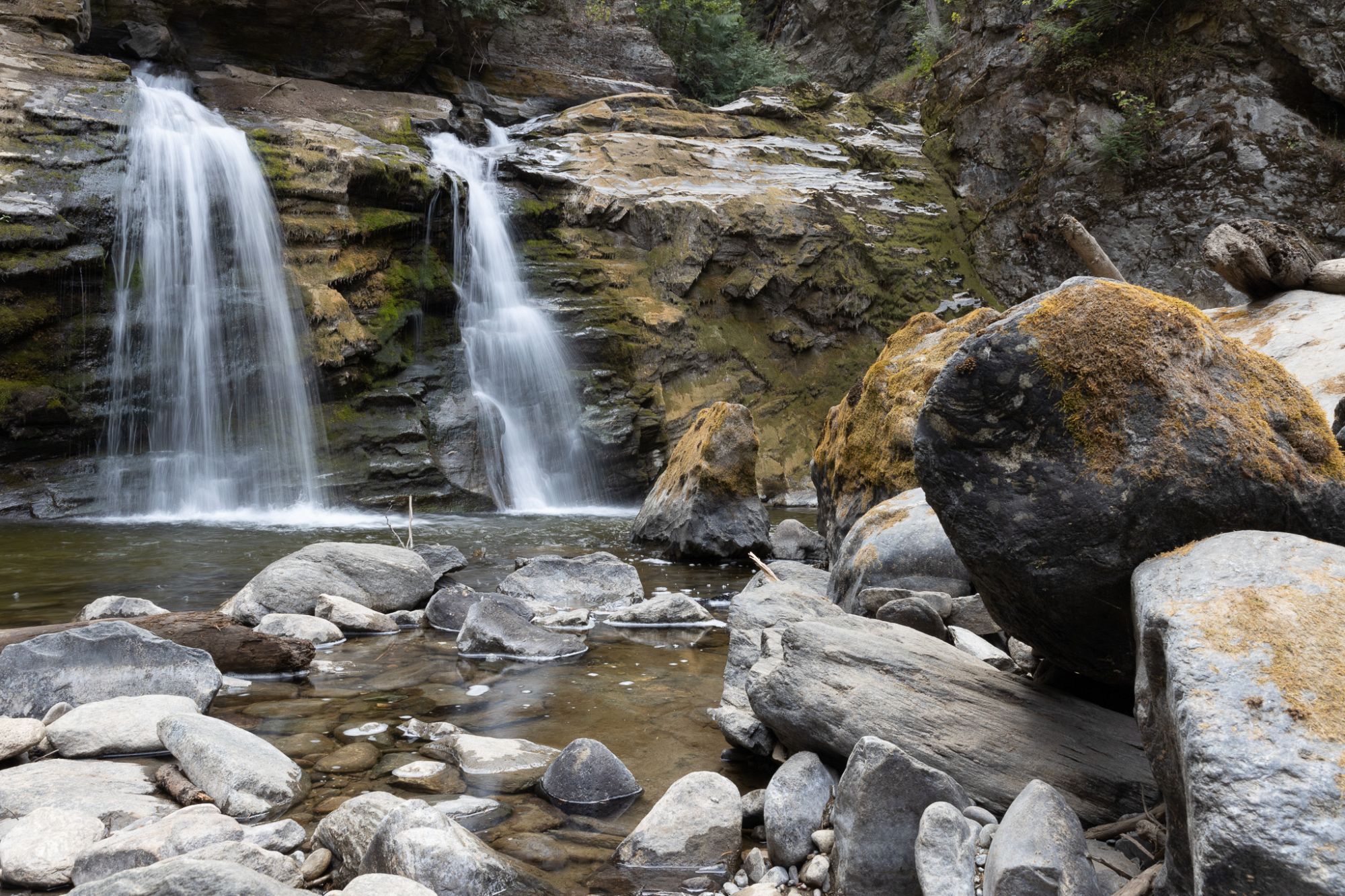
Chase Creek Falls
Chase & Area
Trail Information
| Distance | 237 m (one way) km |
|---|---|
| Duration | 0.25 (round trip) |
| Difficulty |  Easy Easy |
| Geo Referenced PDF | View Map |
| Access Map | Google Maps |
| Latitude / Longitude | 50.81914306, -119.67969509 |
| Activities |       |
About
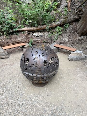
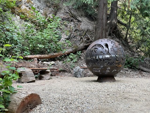
A short, universally accessible trail to dramatic falls. Rest under sweeping cedars while you admire the falls and learn about Secwe?pemc culture at the Stelteglxús Secwépemc Landmark sculpture. Look for Rocky Mountain bighorn sheep on the slopes above. For a longer walk, connect across the bridge to the Scenc ck?wimem?éws (Scatchard Mtn) Trails.
Access
Traveling west on Hwy 1 to Chase, turn right (north) onto Shuswap Ave. Turn left (southeast) on Coburn St, then left (north) onto Poquette Rd. Directly after crossing the bridge, park at the trailhead on the right. The trail passes under the highway bridge.
Photos Submit photos
Nearby Trails
Skmana Lake Trails
Distance: 9848
Duration: 0.5 - 2+ Hours (round trip)
Difficulty: Easy to Most Difficult
Scenc ckwimeméws - Scatchard Mountain Switchbacks
Distance: 5585
Duration: 1 Hour (one way)
Difficulty:  More Difficult
Exploring Respectfully
Shuswap Trails
Fostering a healthy, engaged community in the Shuswap Region – economic/environmental/social – through well designed, maintained, and promoted trails connecting people, culture, and landscape