Tappen Bluffs (Skimikin)
South Shuswap
Trail Information
| Distance | 4.1 km (one-way) km |
|---|---|
| Duration | 1.5+ Hours (one-way) |
| Difficulty |  More Difficult More Difficult |
| Geo Referenced PDF | View Map |
| Access Map | Google Maps |
| Latitude / Longitude | 50.80060139, -119.40259377 |
| Activities |        |
Be well prepared, as this is bear habitat. Watch for vehicles on FSRs and ATV tracks. There is a range license where the FSR crosses the cattleguard. Avoid disruption to cattle.
About
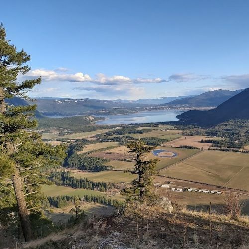
A pleasant forestry road walk or ride up to glorious views over the Tappen Valley to Salmon Arm. Find the Sk?emíke Secwépemc Landmark sculpture at the viewpoint. Can be linked to other Skimikin trails for a longer ride. Short steep final section. Can be linked to the Skimikin Lake Trail System for a longer ride.
Begin your walk or ride from the junction with Trail 40 (130 FSR) and Skimikin Lake Rd. Travel 3 km up Trail 40 enjoying views over the valley along the way. At 3 km take Trail 92 (the smaller ATV doubletrack) uphill on your right to a very steep short climb. But don’t despair, the viewpoint is just a short distance further. Return the way you came.
Access
Follow Hwy 1 for 14.3 km west of Salmon Arm, or 18.6 km east of Sorrento and turn west onto Tappen Valley Rd. After approx. 4 km turn left (west) onto Skimikin Lake Rd. Travel past Recline Ridge Winery, over a cattle gate and just past the CSRD Waste Transfer site. Watch for the next FSR on the right. Look for #130 on a yellow sign attached to a tree and a grey metal transformer to the left of 130 FSR. Park here on the right, just off Skimikin Rd. Stay well clear of the FSR entry. NOTE: The “No Entry” sign applies to the road straight ahead leading to a gravel quarry and old district dump. Your route takes Trail 40 which starts immediately to your left and goes uphill just past the signs.
Photos Submit photos
Nearby Trails
Mt Tuam Bike Park
Distance: 776
Duration: 0.25 - 0.5+ Hour
Difficulty:  Easy to More Difficult
Necelclánk (Fly Hills) Rotary Skyview Lookout
Distance: 11687
Duration: 0.5 - 2+ Hours (various)
Difficulty:  More Difficult
Sk'emíke (Skimikin) Trails
Distance: 76179
Duration: Various
Difficulty:  Easy to More Difficult
Exploring Respectfully
Shuswap Trails
Fostering a healthy, engaged community in the Shuswap Region – economic/environmental/social – through well designed, maintained, and promoted trails connecting people, culture, and landscape

